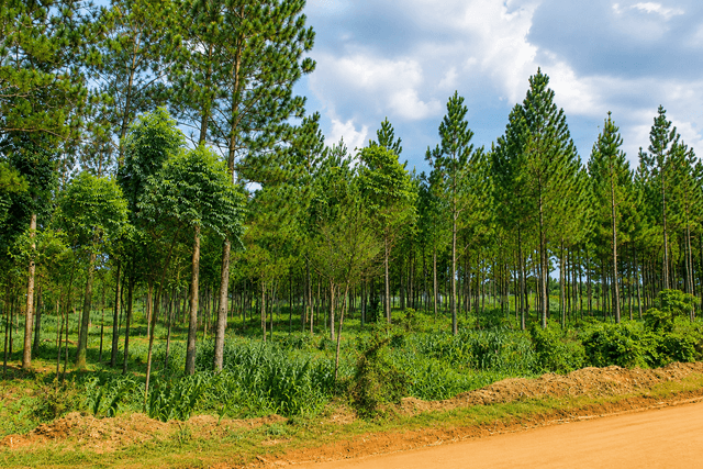
Namavundu Forest Boundary Reopening Revived After Years of Disputes
For nearly a decade, the question of where Namavundu Central Forest Reserve begins and where private land ends has carried more than the weight of survey maps and boundary pillars. It has carried memories of suspicion, fears of displacement and a deeper question about whether conservation and human development can coexist.
Now, eight years after residents protested plans to re-demarcate the forest, a new effort is taking shape—one that government says will be guided by law, consultation and the search for common ground.
The Ministry of Water and Environment (MWE) has agreed on a modus operandi with Jinja District Local Government and Jinja City officials to set the ground for reopening the boundaries of the 704-hectare Namavundu Central Forest Reserve, aiming to curb forestry and environmental degradation.
The high-level stakeholder engagement, held at the Jinja District headquarters, forms part of a broader five-year conservation initiative for the Kalagala and Itanda Falls Conservation Area. The project, co-implemented by the Department of Environmental Management and Protection and the Forestry Management Department under MWE, and funded by the Government of Uganda, covers key ecosystems across Kayunga, Kamuli, Buikwe and Jinja districts, as well as Jinja City.
These ecosystems include riverbanks and the Central Forest Reserves of Namavundu, Itanda and Kalagala Falls.
MWE’s delegation was received by LC5 Chairperson Mr. Moses Batwala, Deputy LC5 Mr. Joseph Ikola, Chief Administrative Officer (CAO) Mr. Emmanuel Wamburu and Deputy CAO Mr. Hussein Malunda.
Speaking during the meeting, Leo Twinomuhangi, team leader from MWE stressed that the boundary exercise is purely legal and consultative, rather than an eviction drive.
“Our main focus is to prepare a successful project through a transparent, legal, and mutually agreed-upon process that minimizes conflicts with adjacent communities. Ministry surveyors will rely on original 1932 gazette plans to re-establish visible boundary marks,” Twinomuhangi said.
In October 2018, about 300 families living in 10 villages around Namavundu and Nile Bank Central Forest Reserves in Butagaya and Budondo sub-counties in Jinja District protested plans by the then National Forestry Authority (NFA) to open new boundaries.
Residents argued that the boundaries were already known and feared that creating new ones could trigger land disputes.
At a harmonisation meeting hosted by NFA in Wansimba village, Butagaya Sub-county, LC3 Chairperson Abdallah Suuta called for residents to participate in the process, saying this would help remove suspicion of land grabbing.
“The forest boundaries are already known to us as the 100 meters from the lake shores, therefore anything beyond that will not be tolerated,” he said.
At the time, Kyoga Range Manager Stuart Maniraguha dismissed allegations of land grabbing, saying NFA had embarked on public awareness about the demarcation process before installing boundary marks.
The concerns raised in 2018 and the years that followed, were not merely about trees. They were about land, homes, livelihoods and trust.
Uganda’s experience with forest and riverbank demarcation shows that conservation cannot succeed through maps alone. Government records from the period acknowledge that communities around the Nile protection zone questioned how they would benefit from conservation if access was restricted, whether those affected would be compensated and what incentives would encourage them to restore trees.

The challenge, therefore, is not simply to redraw a line. It is to make the line understood, legitimate and respected.
District Leaders Pledge Support for the Exercise
The CAO, Emmanuel Wamburu confirmed that technical staff have been strictly instructed to block illegal land titling in protected areas.
“Land does not expand, yet our population grows daily, creating immense pressure. We must hold ourselves accountable and set high standards for our communities,” Wamburu said.
Deputy CAO Hussein Malunda welcomed the livelihood packages, noting that community buy-in is vital for long-term conservation.
While acknowledging that some encroachers are influential individuals, he expressed confidence that inter-agency cooperation would enforce the law effectively.
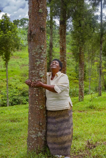
Namavundu is not an isolated patch of woodland. Central Forest Reserves provide public services that extend far beyond the trees standing inside their boundaries. MWE identifies these services as including soil stabilisation, protection of water catchments, riverbanks and lakeshores, biodiversity conservation, climate-change mitigation and recreation.
The forest is therefore part of an ecological system whose benefits are shared by people who may never enter the reserve.
The current intervention also builds on years of planning around the Kalagala landscape.
Government records show that the Kalagala Offset Sustainable Management Plan has previously supported riverbank demarcation, restoration and inventories of people and developments adjacent to Namavundu and Nile Bank Central Forest Reserves. The 2019 Water and Environment Sector Performance Report also recorded the creation of an extended Kalagala-Itanda Offset Area and community engagement around restoration.
Today, the Ministry is taking this work into a broader framework through the Kalagala and Itanda Falls Conservation and Protection Project (KIFP).
The Ministry says KIFP will run to 2031 and is designed to address pressures associated with the Bujagali and Isimba hydropower developments while protecting biodiversity, fisheries, cultural resources, fragile ecosystems and eco-tourism. Its activities include degraded forest restoration, fish-breeding-area restoration, eco-tourism promotion, community livelihood enterprises and riverbank management.
The project is also ambitious in scale. MWE says 2,400 kilometres of River Nile protection buffer zones are planned for demarcation and restoration using indigenous trees, alongside plans to gazette the Nile protection buffer as a Special Conservation Area.
The boundary reopening directly supports presidential directives to safeguard Uganda’s forests, wetlands and riverbanks.
Mr. Twinomuhangi warned that unchecked environmental destruction has worsened natural disasters such as landslides and flooding across the region.
He cited illegal land titling in protected zones including forest reserves, lakeshores and islands along the River Nile as a major issue driven by impunity. To counter this, the ministry is rolling out comprehensive management plans covering forests, wetlands and fisheries, alongside environmental audits and strict licensing frameworks.
The warning comes at a time when Uganda’s forest estate faces continuing pressure. NFA says Central Forest Reserves collectively cover more than 1.26 million hectares and provide essential ecological services, but also acknowledges persistent deforestation and degradation requiring sustained investment in enforcement, restoration and community participation.

There is, however, a difficult balance at the heart of Namavundu.
Jinja is growing. Communities need land. Families need homes, farmers need productive ground and young people need economic opportunities. At the same time, forests, wetlands and riverbanks cannot simply be treated as vacant land waiting for the next development project.
The deeper question is what kind of development can survive without destroying the ecological systems that make it possible.
A forest reserve can regulate water, protect soils and support biodiversity. A functioning riverbank can reduce erosion and protect water quality. A healthy landscape can sustain agriculture, fisheries, tourism and other livelihoods. Once these systems are degraded, the cost of replacing their services often falls on the same communities that depended on them.
The Ministry says this is why boundary restoration, when done properly, should be more than an enforcement exercise. It should become an opportunity to clarify land rights, prevent future disputes, restore degraded ecosystems and create legitimate economic alternatives for communities living alongside protected areas.
The Ministry’s own framework recognises that forest management plans should be prepared in consultation with local communities. Its current records list the Kalagala Falls, Nile Bank and Namavundu Central Forest Reserves under a 2018–2028 Forest Management Plan area.
That institutional history offers an important lesson: conservation is strongest when communities are not simply told where a boundary is, but understand why it exists and have a meaningful stake in protecting what lies behind it.

Alternative Livelihoods and Community Engagement
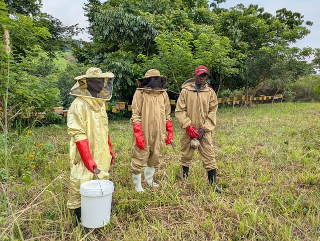
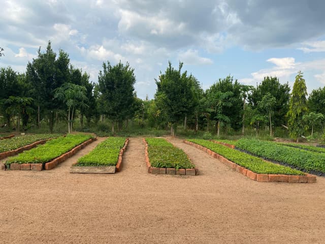
To ease local pressure on protected land, the ministry will offer alternative economic activities, including beekeeping and sustainable biomass projects. Additionally, free tree seedlings will be distributed to residents from the Kimaka nursery bed.
A dedicated Conflict Redress Team will handle disputes, while local government structures from sub-counties to villages will be engaged to ensure transparency.
This could become one of the most important differences between the current exercise and the fears that surrounded the 2018 demarcation debate.
The story of Namavundu is ultimately larger than 704 hectares.
It is about whether Uganda can protect its remaining natural assets while its population and economy continue to grow. It is about whether government agencies can work together rather than operate in isolation. And it is about whether communities can be treated as partners in conservation rather than merely as people living on the wrong side of a boundary.
The Ministry’s KIFP inception process was intended to introduce stakeholders to the project and create a shared understanding of their respective roles. That approach is important because the Kalagala landscape does not respect administrative boundaries. Forests, riverbanks, wetlands, fisheries, cultural sites and communities are connected.
The Sustainable Management Programme similarly sought to protect the spiritual and cultural values of the Kalagala Offset while conserving the ecosystems of Mabira Central Forest Reserve, Kalagala Falls, the River Nile banks and Namavundu Central Forest Reserve across Kayunga and neighbouring districts.
A clearly established boundary can protect a forest. A protected forest can protect a river. A healthy river can support communities, energy, fisheries and tourism. And communities that see tangible benefits from conservation are more likely to become its strongest defenders.
For Namavundu, the reopening of its boundaries therefore offers more than a return to old maps.
It offers a chance to redraw the relationship between people, land and nature—with greater transparency, stronger institutions and a shared understanding that protecting the forest is not about stopping development.
It is about ensuring that development has a future.